Authorized Dealer
You'll be able to communicate with the folks back home, and emergency responders if necessary, with the Garmin GPSMAP H1i Plus Premium GPS Handheld Navigator with inReach Plus Satellite Technology. Loaded with…
Product highlights and buying context
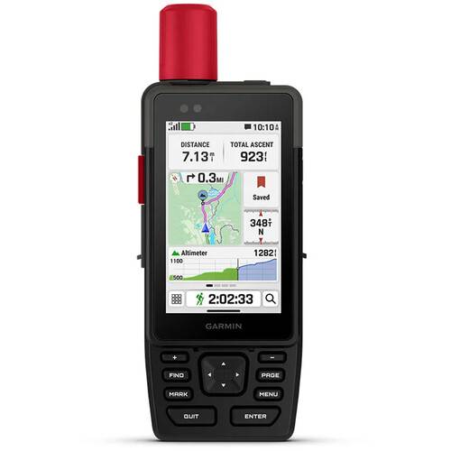
You'll be able to communicate with the folks back home, and emergency responders if necessary, with the Garmin GPSMAP H1i Plus Premium GPS Handheld Navigator with inReach Plus Satellite Technology. Loaded with topographical maps of North America, able to access satellite imagery and other maps, and easy to operate even in bad weather, the H1i Plus keeps you on track in the wild. Multiband GPS and multi-GNSS services pinpoint your location. You can get crucial weather info from the Garmin Explore phone app, which also makes it easy to plan trips and store routes.
Using satellite communication requires a subscription to InReach. Waterproof and shock resistant, the H1i Plus comes with a built-in Garmin Spine Mount 2 and a removable carabiner. It can run for 145 hours in the GPS mode and is USB-C rechargeable.
With an active inReach subscription, send group text messages up to 1600 characters and exchange photos and voice messages when outside of cellular coverage.
Multiband GPS and multi-GNSS provide superior positional accuracy.
Trigger an interactive SOS message anytime to the 24/7-staffed Garmin Response international coordination center for help in an emergency.
Download high-resolution photorealistic maps directly to your device via Wi-Fi technology. Find trails, pick stand locations and parking, create waypoints and more.
Navigate every trail with "ABC" sensors, including an altimeter for elevation data, barometer to monitor weather, and 3-axis electronic compass.
Download high-resolution, photorealistic maps directly to your device via Wi-Fi. Easily find trails, pick stand locations and parking, create waypoints and more. Preloaded TopoActive maps of the U.S., Mexico, and Canada show you terrain contours, topographic elevations, summits, parks, coastlines, rivers, lakes and geographical points. With an Outdoor Maps+ subscription, you get public land information, landowner names, state plat maps, hunting management unit boundaries, BLM boundaries and more.
The bright, sunlight-readable 3.5-inch color touchscreen has chemically strengthened glass to resist scratches. It is glove-friendly, easy to see, and easy to use. Tap, zoom and swipe on the maps to follow your route.
The rugged hybrid design also features intuitive push buttons for more versatility when operating in weather and while wearing gloves. The quick-action button lets users customize functions to their specific needs.
Get real-time forecast information so you're aware of the changing conditions. Requires an active Wi-Fi connection, or an active cellular connection and use of the Garmin Explore app on your paired compatible smartphone.
Plan, review, and sync waypoints, routes, and tracks by using the Garmin Explore app and website. You can even review completed activities while still in the field. You can also get real-time forecast information, so you're aware of changing conditions.
See upcoming climbs on your route, when they will occur, and how steep they will be.
Additional Details
Loading…
